 Self Guided Float Trip of Lake Ouachita
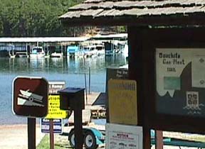
Get the free guidebook from the Arkansas Geological Survey, the Spillway or Brady Landing on Lake Ouachita, and you will be set to follow the marker buoys around interesting and scenic Lake Ouachita.
Boat rental can be arranged with Spillway Resort at 501-767-2997.
The first of its kind, this float trip was a project of the US Army Corps of Engineers, the Arkansas Geological Survey, and the US Geological Survey. Lake Ouachita is located 13 miles northwest of Hot Springs, in the heart of the Ouachita Mountains. The lake and adjacent land areas are managed by the Corps. The guidebook begins with this introduction:
Welcome to a region where, 250 to 300 million years ago, the earth's surface was bent, twisted, and deformed in ways that still baffle professional geologists. The self-guided Ouachita Geo-Float Trail takes you, in your own boat, across the water of Lake Ouachita to some of the most unique geologic features in the world.
As the seasons change, so do the natural features of Lake Ouachita. During the fall and winter months it is easier to view the geologic features because the water level is low, but remember, low water levels can make boating hazardous because rocks, stumps, and other obstructions are closer to the surface and the bottom of your boat! Also watch the weather, the time of day, and the gas gauge. Safe boating will make your day more enjoyable
The Ouachita Geo-Float trail includes many unique geologic features on the lake, but by no means points out all the interesting natural features you will see. The trail is a 16 mile (25.7 km) trip from the Spillway Recreation Area to Brady Mountain Recreation Area, and will take about 1-1/2 hours to complete. The time will vary depending on your boat's speed and the time you spend at each stop. Follow the map to the bright yellow buoys which mark specific stops along the route. For better understanding of the features, we suggest that you begin at Stop A and continue in alphabetical order.
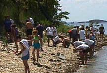
 THE SHORELINES of Lake Ouachita show the complex structures of the geological formations of the Ouachita Mountains. This area has been studied intensively by geologists, and also in a more relaxed manner by sightseers from boats taking the Geo Float trip. The photos here are from Project GO (Geology Orientation), a summer field camp of outstanding students, as they toured the lake.
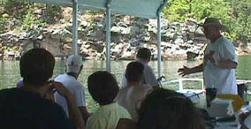
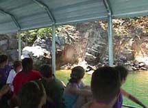
Geologist Charlie Stone explains some of the contacts and bedding features that are found at the different buoy markers along the Geo Float.
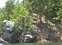
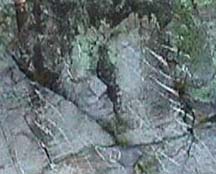
Left, folds in the Mazarn unit. Right, the contact of the Mazarn and the Blakely formations.
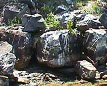
Left, Whirlpool rock, where a whirlpool churned in the current of the Ouachita river before it was dammed to form Lake Ouachita; right, our geologist guide points out the beauty of the structure, and to quote, he says, "Any dern fool can see the bedding".
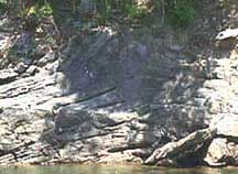
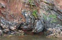
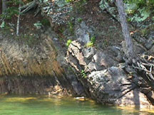
Left, graded beds near the submarine slide; right, folds showing how plastic the rock was.
Zebra rock. White quartz veins in the rock show up dramatically. Although crystals can be found on the shoreline of the lake, digging, or destruction of property, will result in a citation from the ranger.
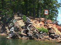
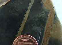
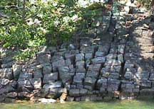 Checkerboard Point. The cracks in the sandstone formed much in the same way as if you bent metal near its breaking point. When this area was being pushed up into mountains, the harder rock layers were fractured. While these hard sandstone layers were cracking under compression, the other softer layers nearby flowed with the pressure and eventually folded.
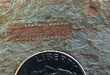
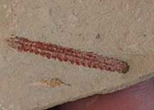
Looking for fossil graptolites, and some examples of what they found.
More information is available online from the Arkansas Geological Survey.