The Formation of the Ouachita Mountains
GEOLOGISTS COME from all over the world to see the strange and curious geologic formations of the Ouachita Mountains. The mountain building process, called orogeny or orogenesis, did a wondrous job of creating folds, faults, and overturned layers of rock.
The Ouachita Mountains are old. Once upon a time they were much like the Rocky Mountains of the western United States, but millions of years of weathering and erosion have removed the tops of the mountains and now let us see into the middle parts, but not the roots, of the mountains.What happened to make such unusual layers in the rocks? Have you read about plate tectonics yet? Well, that's a lot of it. Mountains can be built by volcanoes, or by a block of land that is uplifted (or squeezed up) between two faults as a result of compression or tension in the earth's crust, or by folding and faulting where plates push together.
The Ouachita Mountains are fold mountains, just like the Appalachian Mountains. Where oceanic crust meets less dense continental crust, the oceanic crust is forced under the continental crust. The continental crust is buckled by the impact, and fold mountains result.
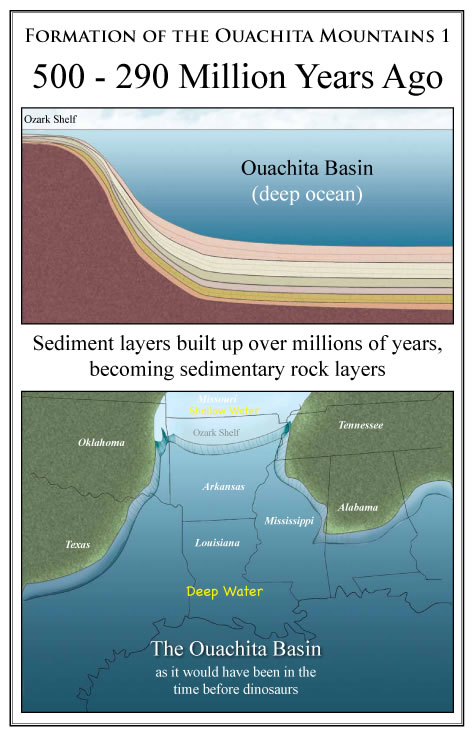
Back in the early times before the dinosaurs, Arkansas was on the shore of a deep ocean, called the Ouachita Basin. You know how the Gulf coast is around New Orleans now? With all the sediment and deltas that the Mississipi River washes out? The Ouachita basin had had millions of years of sediment washing into it from the erosion of the North American continent, so there were deep layers of this material on the ocean bottom.
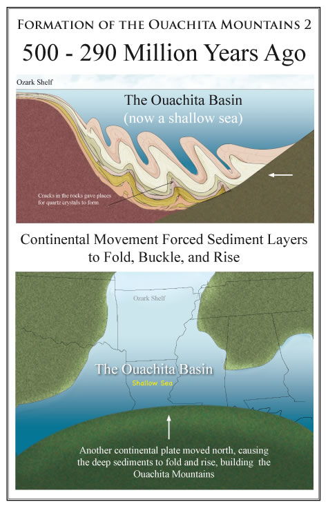
In the movement of the continental plates, South America came waltzing this way, causing the ocean area to become smaller as the plates converged.
The ocean floor had to go somewhere, and it rippled up against the continental margins of North America. The ocean got shallower as South America (or another continental plate) came closer. The sediments, which were now sedimentary rock, were squeezed and folded like a rug that gets pushed against a wall. The brittle units faulted, allowing large sheets of land to override (called low angle thrust faulting) the land to the north. Many times the folded rocks cracked, allowing fluids from deep in the earth to fill in the cracks. That's how all the quartz crystal came to be in the mountains.
All of this process took a good long time -- Geologic Time. By the time the dinosaurs showed up, the colliding continental plate had either bounced off or sunk, and Arkansas was left with a shallow sea and a new set of mountains.
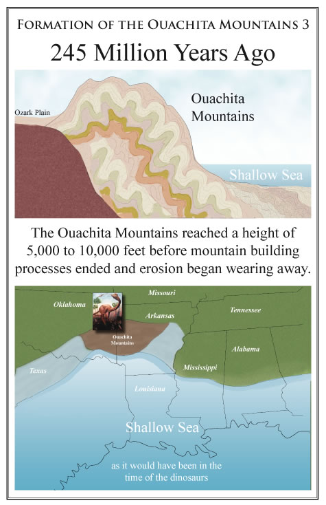
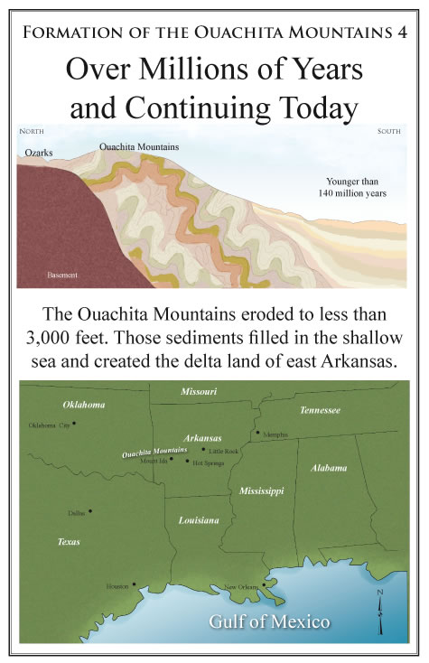
Water and wind erosion never sleep. Over more millions of years, these constant forces whittled a couple of miles off the tops of our mountains. With that material, the shallow sea filled in, leaving the east Arkansas Embayment region, called the delta by many, and the West Gulf Coastal Plain as today's remains of these forces of nature. But it didn't stop there.
It created Louisiana and all of the southeastern gulf coast that we know and love. That's why people from Texas and Louisiana come to Arkansas to collect rocks, and why people from Arkansas drive eight hours south for our seashore vacations.
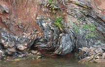
Want to see what the Ouachita Mountains look like today? See the header at the top of this page. It's the Ouachita Mountains between Hot Springs and Mount Ida.
It would be good for you to review the related geology pages after reading this story. The geologic summary of Arkansas may make more sense in this context. But realize that this version of the mountain building events is greatly simplified, and you could spend your entire lifetime studying this very event, like a few geologists, including Mikey, do!!!